
Screenshots
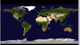


App details
- Version
- 0.99.88
- Size
- 8.50 MB
- Updated
- October 13, 2020
- Requires
- Windows ME
- Language
- English
- License
- Free
- Developer
- Ww2d
- Category
- Windows OS
SoftPas in:
This product is also available in the following languages:
About WW2D
Download WW2D – Free Open‑Source NASA World Wind Viewer for Windows
Overview of WW2D (Windows World Wind Desktop)
WW2D is a lightweight, free (GPL‑licensed) Windows application that brings NASA’s World Wind globe‑visualization technology to the desktop. First released in 2005 and continuously refined, the current build (0.99.88) was updated on January 30 2007. The program belongs to the Science & Education category, with a sub‑category focus on Geography, making it an excellent learning tool for students, educators, and hobbyists who want to explore satellite imagery, terrain data, and geographic layers without the need for an internet connection.
The software runs on legacy operating systems, specifically Windows 98 and earlier versions, which is rare for modern GIS tools. This makes WW2D a valuable option for users maintaining older hardware in schools, libraries, or remote locations where newer Windows releases are unavailable. Despite its age, the application remains surprisingly capable thanks to a revamped user interface, a powerful Bookmarks tool, embedded scripting support, an improved Layer Manager, and an Add‑on Manager that allows extensions to be installed easily.
Since its addition to the catalog in 2005, WW2D has been downloaded more than 83 000 times, with recent activity concentrated in India, the United States, and Bulgaria. The program’s modest storage footprint (under 30 MB) and its English‑only interface contribute to fast download times and a simple learning curve, especially for users new to geographic information systems. Whether you’re a teacher preparing a lesson on plate tectonics, a traveler planning a route, or a hobbyist curious about global weather patterns, WW2D offers a secure, free, and offline‑ready solution.
Key Features that Set WW2D Apart
- New User Interface: A clean, modern layout replaces the older World Wind panels, making navigation intuitive for beginners and seasoned GIS users alike.
- Bookmarks Tool: Save and retrieve favorite locations with a single click, enabling quick access to frequently visited regions.
- Embedded Scripting Support: Users can write and execute scripts directly within the application, extending functionality for custom data analysis or automated tasks.
- Improved Layer Manager: Organize, toggle, and configure multiple data layers—such as satellite imagery, topography, and political boundaries—without performance lag.
- Add‑on Manager: Install third‑party extensions or community‑developed plug‑ins to enhance visualizations, add new data sources, or integrate with external tools.
- Internationalization Settings Editor: Although the default language is English, the editor allows developers to add translations, broadening the software’s global reach.
- Lightweight Footprint: The installer is under 30 MB, ensuring minimal impact on storage and quick installation even on older machines.
- Offline Capability: Once data layers are downloaded, the globe can be explored without an internet connection, perfect for remote fieldwork.
These features combine to deliver a powerful yet approachable geographic exploration platform. The scripting engine, for instance, supports basic Python and JavaScript, enabling users to automate repetitive tasks such as batch‑downloading imagery or generating elevation profiles. Meanwhile, the Add‑on Manager’s open architecture encourages a community of developers to share custom layers—ranging from historical maps to real‑time weather overlays—keeping the software fresh long after its last official update.
Because WW2D is open source, its source code is freely available on public repositories, inviting contributions, bug fixes, and enhancements from the global developer community. This transparency not only improves security but also guarantees that the application can be adapted to niche academic projects or specialized industry workflows without licensing constraints.
Step‑by‑Step Installation & Usage Guide
Downloading the Installer
To begin, navigate to the official WW2D download page (linked from reputable software directories) and click the “Download WW2D 0.99.88” button. The file is a compact .exe installer, typically named WW2D_setup.exe. Since the program is free and open source, there are no hidden fees or registration requirements. Ensure you download from a trusted source to avoid tampered binaries.
Installation Process
- Run the
WW2D_setup.exefile. Windows may prompt you with a security warning; click “Run” to proceed. - Accept the GPL license agreement, then choose the destination folder (the default
C:\Program Files\WW2Dworks well). - Click “Install” and wait for the progress bar to complete. The installer automatically creates start‑menu shortcuts and a desktop icon.
- When installation finishes, you may be asked to restart the computer. A restart is optional but recommended for older Windows versions to refresh system paths.
Launching and Navigating the Globe
After installation, launch WW2D via the desktop shortcut or start‑menu entry. The main window displays a 3‑D globe centered on the equator. Use the mouse wheel to zoom, click‑drag to rotate, and double‑click to focus on a location. The top toolbar provides quick access to common functions: “Home” resets the view, “Bookmarks” opens your saved locations, and the “Layer Manager” lets you toggle data sources.
Saving Bookmarks and Adding Layers
To bookmark a site, navigate to the desired point, then click the “Add Bookmark” icon. Assign a name and optional description; the bookmark appears in the Bookmarks pane for instant retrieval. Adding new layers is performed via the “Add‑on Manager”: click the gear icon, browse the online repository, select a layer (e.g., “Global Night Lights”), and click “Install”. Once installed, the layer becomes available in the Layer Manager where you can adjust opacity and order.
Utilizing Embedded Scripting
Advanced users can open the “Script Console” from the Tools menu. Here you can write small scripts in Python or JavaScript to automate tasks—for example, a script that iterates over a list of coordinates and captures screenshots. The console also provides debugging output, making it easier to troubleshoot custom code.
Overall, WW2D’s installation is straightforward, and its user‑friendly interface ensures that even users with minimal GIS experience can start exploring the world within minutes.
Compatibility, Advantages & Drawbacks – FAQ and Final Verdict
WW2D is designed for legacy Windows platforms, specifically Windows 98, Windows ME, Windows 2000, and earlier builds of Windows XP. The application does not officially support modern Windows 10/11 environments, although it often runs in compatibility mode. Because the program’s requirements are modest (a 1 GHz processor, 256 MB RAM, and a graphics card supporting OpenGL 1.1), it performs well on older hardware that struggles with contemporary GIS software.
Pros & Cons
- Pros
- Free and open‑source – no licensing fees.
- Lightweight installer and low system requirements.
- Rich feature set (bookmarks, scripting, add‑on manager).
- Works offline once data layers are cached.
- Strong community support for extensions and bug fixes.
- Cons
- Limited to legacy Windows OS; no native support for Windows 10/11.
- English‑only interface; internationalization requires manual editing.
- Last official update was in 2007, so some newer satellite datasets are unavailable.
- Graphics rendering is basic compared to modern 3‑D GIS platforms.
Frequently Asked Questions
Is WW2D still safe to download given its last update was in 2007?
Yes. The source code is open‑source and has been reviewed by the community. As long as you download the installer from a reputable site (such as the original project repository or a trusted software catalog), the executable is free from malware. However, because the software is older, it may lack recent security patches, so it’s advisable to run it on an isolated or non‑critical machine.
Can I use WW2D on Windows 10?
While not officially supported, WW2D often runs under Windows 10’s “Compatibility Mode” for Windows 98/XP. Right‑click the shortcut, select Properties → Compatibility, choose “Windows XP (Service Pack 3)”, and launch the program. Some graphical glitches may appear, but basic functionality typically remains intact.
What kinds of data layers can I add?
WW2D supports raster imagery (satellite photos, aerial maps), vector layers (borders, roads), and elevation models. Through the Add‑on Manager, you can also install community‑created layers such as historical maps, climate data, or night‑light visualizations. Layers are stored locally, allowing offline access after the initial download.
Is there a mobile version for Android or iOS?
No. WW2D is a Windows‑only desktop application. For mobile devices, NASA offers the “World Wind Mobile” app on Android and iOS, which provides a similar globe experience but is not the same software package.
How can I contribute to the project?
Since WW2D is GPL‑licensed, you can fork the source code from its public repository, submit bug reports, or develop new add‑ons. Contributions are welcomed via the project’s mailing list or GitHub page. Documentation on building the application from source is included in the repository’s README.
Conclusion & Call to Action
WW2D remains a compelling choice for anyone needing a free, offline, and lightweight geographic viewer on older Windows machines. Its robust feature set—bookmarking, scripting, and extensible add‑ons—delivers more than just a simple globe, providing a platform for education, research, and hobbyist exploration. While the lack of native support for modern operating systems and the absence of recent data updates are notable drawbacks, the application’s open‑source nature means that motivated users can still extend its life through custom scripts and community add‑ons.
If you operate legacy hardware, teach geography in a resource‑constrained environment, or simply enjoy tinkering with open‑source GIS tools, download WW2D today and start navigating the planet without leaving your desk. Click the button below to begin your free download, and join the community of users who keep this classic software alive.
Overall Rating: 4 out of 5 stars – A solid, free GIS viewer for legacy Windows systems.
Guides & Tutorials
How to install WW2D
- Click the Download button above.
- Once redirected, accept the terms and click Install.
- Wait for the WW2D download to finish on your device.
How to use WW2D
This software is primarily used for its core features described above. Open the app after installation to explore its capabilities.
User Reviews
No reviews yet. Be the first to share your experience.
You may also like
more
Llama 2
Free-to-use large language model As the new addition to Meta’s arsenal of langua...

NotebookLM
Revolutionizing the note-taking and idea-generation process NotebookLM is an exp...

Github co pilot
AI-inspired software development and coding platform GitHub Copilot is a browser...

Google Gemma
Google’s lightweight AI models Introducing Google Gemma , a family of cutting-ed...

AI Image Enlarger
A free app for Windows, by ai-image-larger. AI Image Enlarger is a free software...

DALL E
AI-driven text-to-image transformation engine DALL·E is a free graphic and desig...